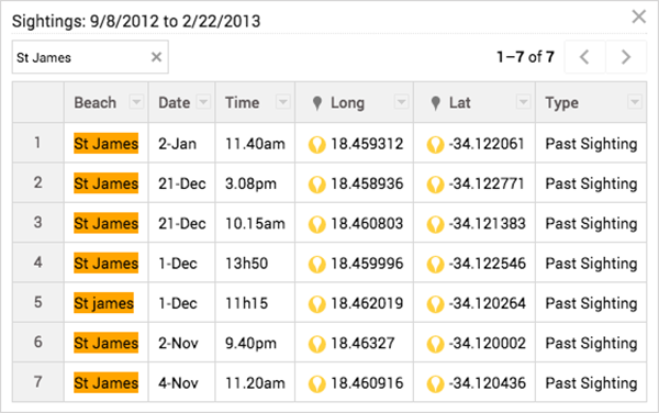
In the Sightings layer, go the layer menu pulldown, indicated by three dots, and select Open data table : Use the search box to searc...
In the Sightings layer, go the layer menu pulldown, indicated by three dots, and select Open data table:

Add points, lines, polygons and directions to your map
Hand-draw points, lines and polygons on your map with the drawing tools. Click the hand icon to stop drawing. You can also save driving, bicycling or walking directions to the map. Use the ruler icon to measure distances and areas.

1- Import your data to Google My Maps
2- Style your map on Google My Maps
3- Change the style of your base map on Google My Maps
4- Edit your map data on Google My Maps
5- Label your data on Google My Maps
6- Share and embed your map from Google My Maps
7- Search and filter your data on Google My Maps
8- Embed your map from Google My Maps


COMMENTS