Satellites have become synonymous with space exploration, but their impact extends far beyond orbiting distant planets. One invaluable use f...
Satellites have become synonymous with space exploration, but their impact extends far beyond orbiting distant planets. One invaluable use for these orbiting marvels is capturing images of our home planet, Earth. These satellite images, also known as spaceborne photography or Earth observation imagery, provide us with a unique perspective on our world, offering benefits that extend far beyond simple curiosity.
A Bird's-Eye View of Everything:
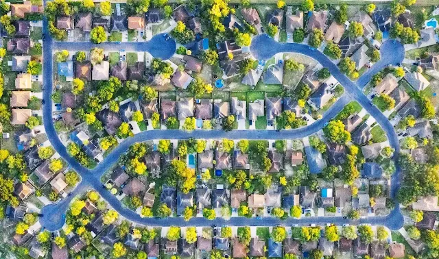
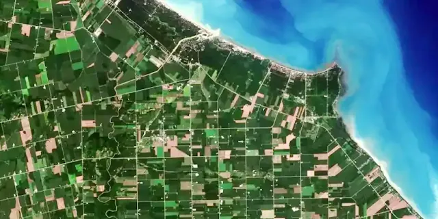
Satellite imagery comes in a variety of resolutions, ranging from high-definition views that can distinguish individual buildings to wider shots capturing entire landscapes. This versatility allows us to monitor environmental changes, track deforestation, assess the impact of natural disasters, and even map uncharted territories.
More Than Just Pictures:
Beyond visual information, some satellites collect data beyond the visible spectrum. This includes hyperspectral imagery, which captures information on different wavelengths of light, revealing details invisible to the naked eye. This data is used for tasks like monitoring crop health, tracking pollution levels, and identifying mineral deposits.
Applications Abound:
The uses of satellite imagery are vast and ever-growing. Here are just a few examples:
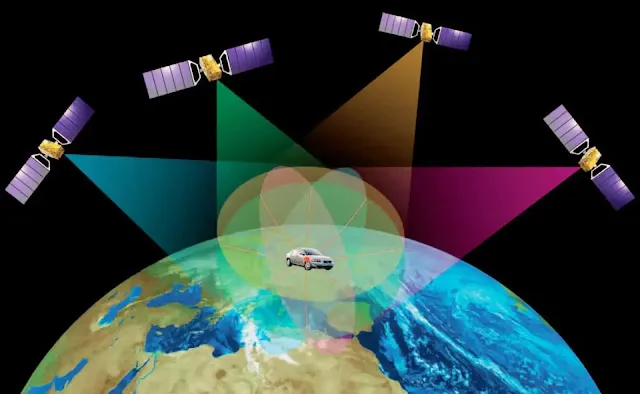
Navigation: Satellite images form the backbone of popular mapping apps like Google Maps and Apple Maps, providing accurate and up-to-date information for navigation.
Weather forecasting: Real-time satellite images help meteorologists track weather patterns, predict storms, and issue timely warnings.
Urban planning: Cities use satellite imagery to monitor growth, plan infrastructure development, and manage resources effectively.
Agriculture: Farmers use satellite data to monitor crop health, optimize irrigation, and predict yields.
Archaeology: Satellite images have revealed hidden archaeological sites and helped map ancient settlements.
The Future of Seeing from Above:
Advancements in satellite technology are happening at a rapid pace. Newer satellites offer higher resolutions, wider coverage, and the ability to collect even more diverse data. This promises to revolutionize our understanding of Earth and its systems, leading to further breakthroughs in environmental monitoring, resource management, and scientific discovery.
So, the next time you look up at the night sky, remember that those twinkling dots aren't just distant celestial bodies. Some of them are our eyes on Earth, providing us with an invaluable perspective on our home planet and its ever-changing story.
Beyond this article:
If you're interested in exploring satellite imagery further, here are some resources:
Google Earth: Explore high-resolution satellite imagery and 3D terrain of the entire globe.
Zoom Earth: View live weather maps, hurricane trackers, and interactive satellite images.
EarthExplorer: Access and download satellite images, aerial photographs, and other data from the U.S. Geological Survey.
GIS Geography: Learn more about different types of satellite imagery and their applications.
By delving into the world of satellite imagery, we gain a deeper appreciation for the complex and interconnected systems that sustain our planet, and equip ourselves with the knowledge to make informed decisions about its future.


COMMENTS