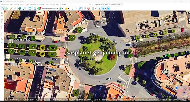
In today's digital era, exploring the world has never been more accessible. Thanks to advanced mapping technologies and sate...
Why Opt for SASPlanet?
Features of SASPlanet:
Diverse Map Sources: SASPlanet provides access to a wide array of map sources, including Google Maps, Bing Maps, OpenStreetMap, and more. Users can effortlessly switch between different providers based on their preferences or specific needs.
High-Resolution Satellite Imagery: SASPlanet offers access to high-resolution satellite imagery, enhancing exploration whether you're navigating urban landscapes or remote wilderness areas.
Offline Capability: SASPlanet enables users to download maps and satellite imagery for offline use, ideal for travelers or researchers without constant internet access.
Geospatial Tools: Equipped with various geospatial tools, SASPlanet allows users to measure distances, calculate areas, and perform other analytical tasks directly within the software interface.
Customization Options: From adjusting map layers to annotating maps with markers and labels, SASPlanet provides a range of customization options tailored to individual preferences.
Downloading SASPlanet:
To download SAS Planet, you can obtain the latest version by following these steps:
1 - Update from Older Version: Check for updates by selecting "Check for Updates" from the "Help" menu in the toolbar. If encountering a map error, utilize the provided SASPlanet patch.
- Download SAS Planet maps error patch: [ Download Link ]
2 - Download the Free Version: Obtain the free version directly from our website. If encountering a map error, use the patch available at the provided link.
- Download SAS Planet: [ Download Link ]
- Download SAS Planet maps error patch: [ Download Link ]
3 - Download the full version of SAS Planet with fixed map error from sasplanet.geojamal.com website :
- Download SAS Planet [with fixed map errors]: [ Download Link ]
With its extensive map sources, high-resolution satellite imagery, and user-friendly interface, SASPlanet is an invaluable tool for exploring the world from your desktop. Whether planning a trip, conducting research, or satisfying curiosity, SASPlanet empowers users to embark on virtual journeys with ease. Download SASPlanet today and discover the world like never before!
See more
Urban Planning & GIS: Maximize Image Resolution with SAS Planet


COMMENTS